The area covered by the Neighbourhood Forum and Plan is that bounded by the Kings Road to the North, the RBKC border to the West, Chelsea Creek and the River Thames to the South and Cremorne Road and Cheyne Walk to Battersea Bridge on the East.
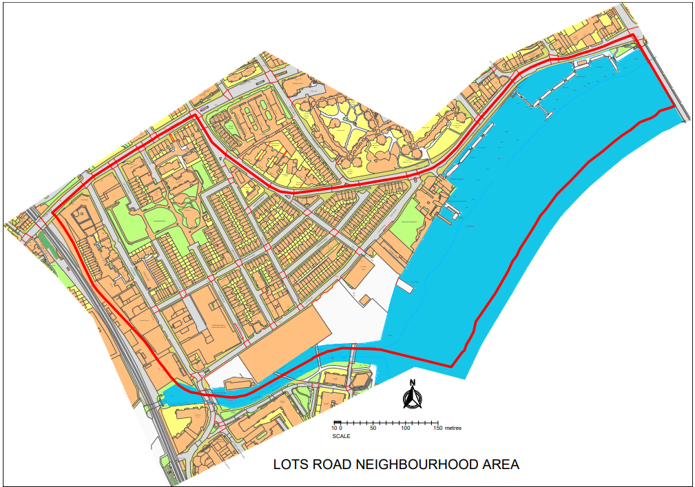
The geographic area covered lies wholly within the Royal Borough of Kensington & Chelsea (RBKC).
The area combines that covered by the Lots Village Chelsea Association of Residents and Businesses, the Pooles Lane Residents Association and the Chelsea Reach Boat Owners Association (CRBA). The area extends to the west to include the Lots Road Employment Zone and to the south to include the new development of the former power station and the protected wharfs along an important and historic part of London’s riverside.